3D Laser
Scanning Services
Using the latest in 3D scanning equipment, software and expertise, our 3D scanning services provide comprehensive, results-driven data to give our customers the most accurate details for all phases of their project.
We are based in Lexington, Kentucky but provide 3D scanning for all of the southeast including Ohio and Tennessee and all points in between.
Contact Our Experts TodayOur 3D Scanning Process
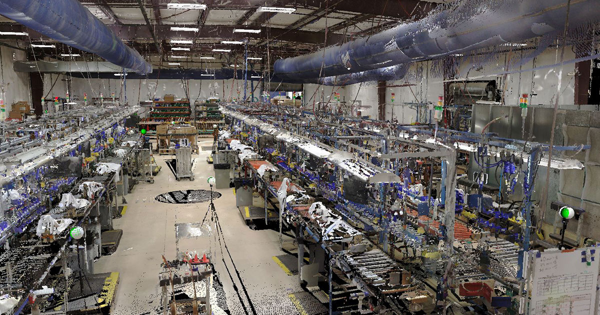
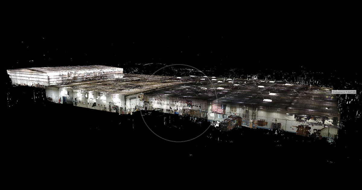
3D Laser Scanning
Kentucky | Tennessee | Ohio | South Carolina
From site documentation to progress monitoring throughout the construction process, 3D Laser Scanning gives you the ability to produce simple and accurate floor plans all the way up to CAD drawings with BIM modeling.
Capture an accurate picture of the existing building conditions, along with data against which to compare the drawings or newly constructed work.
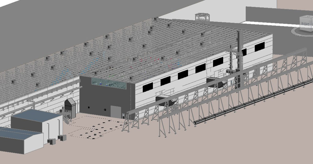
3D/BIM Modeling
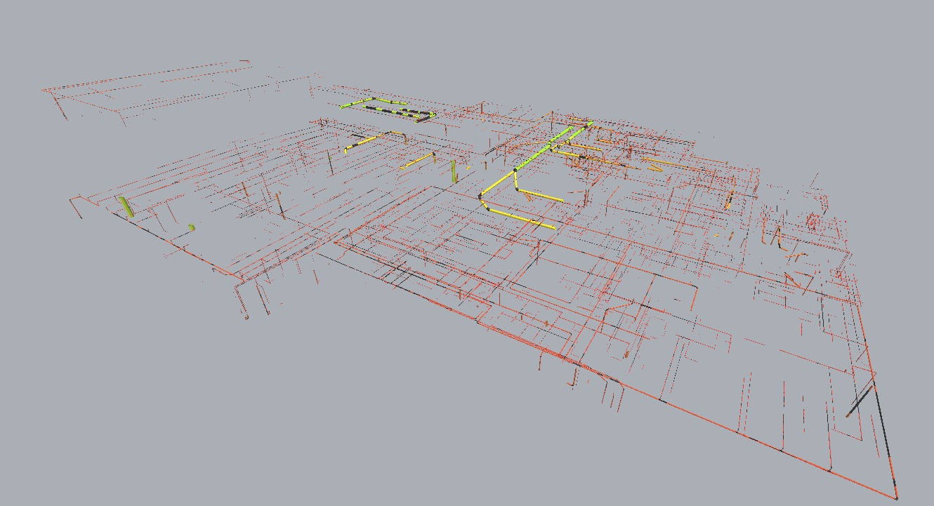
Point cloud scan data can be used to develop intelligent BIM models. Highly accurate 3D laser scanning indicates not only the dimensions and locations of points in your project, but major elements such as plumbing and electrical.
Based in Lexington, KY but also servicing the following cities in Kentucky and beyond:
- Lexington
- Louisville
- Bowling Green
Drone Mapping & Photogrammetry
Aerial imagery, also referred to as aerial photography, describes one of the simplest and most common use for drone imagery services. To capture an aerial photograph, a series of photos, or video, the pilot simply flies over and captures the area photographically.
Using photogrammetric and orthorectification to create a singular mosaic image that corrects geometric distortion and is color corrected/balance for a complete data set, a simple site survey is produced.
These can show elevation changes, perform soil volume calculations for excavation or infill calculations, and can be tied to interior building scans for seamless model integration.
As-Built Plans
Before starting on a project, you need to know what you're up against. As-built surveys capture the exact dimensions and locations of a facility-- vital information for design, renovation, construction, and facility modifications not only now, but down the road for future modifications.
Get an accurate look at the as-built conditions of historical buildings, architecture, and objects with non-invasive 3D laser scanning including floor flatness.
Especially with older buildings, structural safety may be a concern. As-built surveys prepare your crew before they step inside.

Applications & Deliverables
3D Laser Scanning and drone technologies can be deployed to answer countless questions and provide invaluable measurements and dimensions in a timely and cost-effective manner:
- Floor plans and mechanical locations: colorized point clouds
- Data to support structural and architectural planning for building expansions: MEP systems, beam deflection, and floor flatness
- Building acquisition analysis and planning: dynamic point, line, and area features
- Site surveys: digital terrain models, contour maps, and volume calculations
- 3rd party construction monitoring and time lapses: 360-degree imagery
Some of the areas we provide 3D laser scanning services for are:
Kentucky South Carolina
Tennessee Indiana
Ohio West Virginia
North Carolina Southeastern US
Every step of the way, we are there for your design/build needs.
Contact our Experts